Up, Up and Array
This article is from the CW Journal archive.
Unmanned aerial vehicles, also known as drones, are set to revolutionise various domains such as remote sensing, commercial aerial surveillance, oil and gas exploration, and search and rescue emergency operations. In the context of wireless networks, drones could serve as flying base stations able to form emergency flexible and scalable networks in the event of a disaster. They can also be viewed as ‘pop-up’ wireless networks to address surges in bandwidth, such as during an event with massive footfall. Google’s Loon wireless connectivity balloon project reflects the industry’s interest in exploiting drones towards these ends.
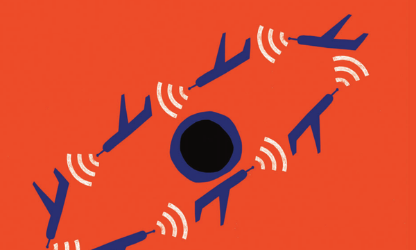
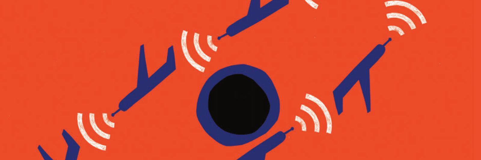
Clusters of drones can be defined as groups of unmanned aerial vehicles, each possessing an independent propulsion system and the ability to interact autonomously with the environment. This formation enables them to perform challenging tasks beyond the ability of individual vehicles. For example, consider a drone cluster hovering over an area. Treating this cluster as an antenna array equips it to localise signal sources on the ground, acting as a flexible array. The term ‘flexible’ here refers to the time-varying array geometry of the drone cluster. Employing array signal processing in conjunction with a drone cluster has the potential to enhance signal-to-noise ratio by exploiting diversity, improving coverage, providing redundancy, and by delivering interference cancellation, clutter suppression, and heightened capabilities of detection, resolution and capacity.
Although useful drone-borne arrays demand complex array processing, they can often take advantage of simple line-of-sight channels for ground to air propagation, in contrast to troublesome multipaths associated with terrestrial propagation channels. Also, based on the mission objective of the cluster, metrics derived from array signal processing could be used to dictate drone formations.
The flexibility of the drone array is a double-edged sword. Conventional array signal processing algorithms are built on the premise of a constant, known and time-invariant array geometry. However, drone clusters experience known perturbations, since each drone has its own propulsion system, and arbitrary unknown perturbations due to sources of turbulence, such as gusts of wind and imperfections in the motors. The cluster of drones therefore forms a ‘flexible array’ which is defined as a class of sensor arrays that have time-variant sensor positions (a time-variant array geometry).
Flexible array signal processing refers to the detection, localisation and reception of signals received by the array. The challenge presented by this is that the array manifold, or array response vector, becomes a function of time and conventional array signal processing algorithms begin to fail.
There’s a class of approaches that attempt to break down this problem, either spatially or temporally, so that time-invariant array techniques may be applied. The overall objective of these approaches is to find an observation space or, alternatively, to use a transformation to obtain an alternative space where time-invariant techniques may be applied. For instance, one school of thought splits the array into rigid subarrays, such that the spatial covariance
flying base stations could form flexible and scalable networks in the event of a disaster.
of the measurements of the subarray can be considered constant1. This enables the use of super-resolution estimation algorithms per subarray, such as Multiple Signal Classification (Music), and the individual estimation spectra are combined to yield the final result. There is a problem in effective combining when the signal-to-noise ratio (SNR) is low, as the gain of the individual sub-arrays is necessarily lower than the gain of the complete array.
Other approaches use linear transformations to transform the time-variant second order statistics of the flexible array to a time-invariant one2. The drawback here is that the transformation only holds true for signals within an interpolation sector, limiting the effective observation space to a small region.
|
GET CW JOURNAL ARTICLES STRAIGHT TO YOUR INBOX Subscribe now |
Another area of research describes models that represent the movement of the drone cluster based on its physics and mission objectives. These mobility models need to capture all the constraints of the drone, such as the inability to make sharp turns or rapid changes in velocity. Mobility model design must also recognise that:
• Drones are required to be autonomous with no ground navigation
• Movements are characterised by an element of unpredictability
• Repetitive scanning of the same area may be required
• A robust connectivity to back-end is essential to route collected data for processing
• The resulting coverage should be robust to the loss or failure of some drones
A semi-random circular mobility model has been shown to be well-suited in terms of coverage and offers reduced collision risk for missions where drones hover over a specific location to gather information3. In other words, the drones revolve in predetermined circular orbits around a leader drone or a reference point in space, and hop to another orbit after a predetermined time. It’s called “semi-random” because motor imperfections and external disturbances add a degree of randomness in the model.
The challenge is to combine the information from physical mobility models of the drone clusters with array signal processing models (both spatial and spatio-temporal). Consider a situation where a cluster of ‘N’ drones is hovering over an area to form a communications network. To steer beams towards the users, the drone array is required to track their locations spatially in terms of angle-of-arrivals at the array. The data from each of these drones can be down-converted, sampled and sent to a centralised controller, which could either be another drone or an aerial reference station – a terrestrial ground station, or a satellite – that would essentially be the brain of the system. These outputs to the controller can be used to construct an N-dimensional complex received-signal that is a function of the partially known time-varying drone formation geometry and unknown user parameters such as azimuth and elevation. The mobility model we talked about earlier provides a way to represent the time evolution of the drone array geometry and, using these two models, a state-space model can be constructed where:
• The unknowns of the system (target parameters and drone array locations) are treated as the states to be tracked, whose time evolution is given by the target and drone mobility models respectively
• The received signal is treated as the measurement signal that is a non-linear function of these states corrupted by observation noise
This state space model formulation, in conjunction with the received signal vector, can be processed by an extended Kalman filter that continually tracks all the unknowns (the filter is required because the transition matrices are non-linear functions).
Simulations using synthetic data4 illustrate that this fused model, when employed with a small cluster of seven drones deployed to hover, improves the mean square error in tracking a target’s azimuth by almost 20 dB, compared to when the mobility model is used in isolation. Further simulations have shown that using a cluster of 20 drones in a 3D formation, such as interlocked circular rings, keeps the target tracking operational at low signal-to-noise ratios. If the number of drones is a constraint, orthogonal time-domain waveforms exploited in conjunction with the spatial domain would enable a small drone cluster of seven drones, for example, to obtain gains equivalent to that of a big cluster of 20 drones. These spatio-temporal techniques can be further exploited to improve multipath discrimination and signal resolution due to the additional temporal dimensions that become available.
There are several challenges that need to be addressed to make drone array signal processing possible. To calibrate gain, phase and clock drifts, a self-calibration phase is required in which the drones may transmit to each other directly, without recourse to controller, to calibrate the resultant phase-error from these uncertainties. The bandwidth of the drone-controller data link is another potential bottleneck that constrains the maximal target speeds of moving targets tacked by the array. Onboard data storage would also dictate the frequency at which the drones would need to transfer data to the controller.
These problems are difficult but solvable and with new high-spec onboard radios, becoming available, practical implementations are on the horizon.
|
GET INVOLVED WITH THE CW JOURNAL & OTHER CW ACTIVITIES |
- D W Rieken and D R Fuhrmann – Generalizing Music and MVDR for Multiple Noncoherent Arrays. IEEE Transactions on Signal Processing, Vol 52, No 9, pp 2396-2406, Sep 2004, p 100
- A Zeua and B Friedlander – Direction Finding with Time-varying Arrays. IEEE Transactions on Signal Processing, Vol 43, No 4, pp 927-937, Apr 1995, p 97
- W Wang, X Guan, B Wang, and Y Wang – A Novel Mobility Model Based on Semi-random Circular Movement in Mobile ad hoc Networks. Information Sciences, Vol 180, No. 3, pp 399-413,
Feb 2010, p 108 - V Sridhar and A Manikas – Target Tracking with a Flexible
UAV Cluster Array. 2016 IEEE Globecom Workshops (GC Wkshps), pp 1-6
Vidhya Sridhar is a consultant at The Technology Partnership (TTP) Plc. She has a background in digital signal processing and physical layer design and development. In her PhD at Imperial College London, she carried out research on array signal processing techniques with applications in 5G and defence. Prior to her PhD, she spent three years working on physical layer design and development in LTE and WiMAX at Broadcom (India) and Alcatel Lucent (India) respectively.